
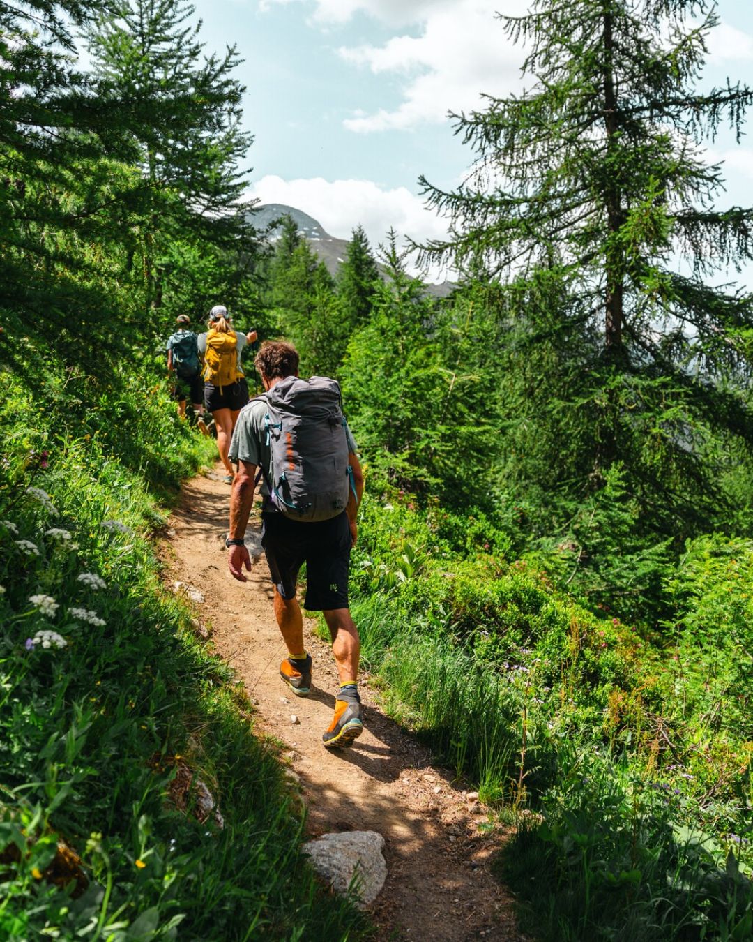
Aiguilles Rouges crossing

Aiguilles Rouges crossing

Aiguilles Rouges Crossing: a 4-Day Self-Guided Trek Facing Mont Blanc

The Aiguilles Rouges crossing — also known as the Tour des Aiguilles Rouges — is one of the finest treks in Haute-Savoie, and one of the least known next to its famous neighbour, the Tour du Mont Blanc. For four days, you walk through the Aiguilles Rouges nature reserve, from Les Houches to Les Praz-de-Chamonix, with the Mont Blanc range in front of you from sunrise to sunset.

The Aiguilles Rouges range lies on the north side of the Chamonix valley, between Servoz and Les Houches to the south-west and Vallorcine and the Swiss border to the north-east. Its ridge lines up peaks between 2,300 and 3,000 m, topped by Le Buet (3,096 m), which you can climb as an option on day 3.

We book your three nights in mountain huts on a half-board basis, and send you a detailed roadbook, an IGN map and GPS tracks. You walk at your own pace, without a guide; our team is on call throughout your trip.

Why choose the Aiguilles Rouges crossing?
  • Mont Blanc in front of you, every day. The range faces the Mont Blanc massif along its whole length: each stage gives a new view of its glaciers and needles.
  • A nature reserve. Ibex, chamois, marmots and, with luck, the bearded vulture circling above the Fiz cliffs.
  • Quieter than the Tour du Mont Blanc. Smaller huts, calmer trails, and only four days to set aside.
  • Two ways to go further. The ascent of Le Buet on day 3, and a detour via Lac Blanc on day 4.
Traversée des Aiguilles Rouges – Trek en liberté. Aiguilles Rouges Crossing – Self-Guided Trek.

Searching Availability...

Aiguilles Rouges crossing itinerary, stage by stage

You set off from the hamlet of Le Bettey, above Les Houches. The trail climbs to the Chailloux pastures, then up the hollow below the Aiguillette des Houches, at the southern tip of the range: a superb viewpoint over the Mont Blanc massif. A short descent leads to the Bellachat hut, high above the Chamonix valley.

⏱️ 7.5 km • 📈 +1,000 m / 📉 -185 m – 3 to 4 hours

Night at the Bellachat hut (2,152 m) · dinner and breakfast

Across the Carlaveyron plateau, you climb to the summit of the Brévent (2,525 m), the high point of the route without the option. You then reach the Col du Brévent and drop to the Pont d’Arlevé (1,597 m) on the GR5. You may spot a bearded vulture circling above the Fiz cliffs. The day ends at the Moëde Anterne hut, near Lac d’Anterne.

⏱️ 12 km • 📈 +795 m / 📉 -960 m – 4 to 5 hours

Night at the Moëde Anterne hut (2,002 m) · dinner and breakfast

You head up to the Col de Salenton, in a stony, high-mountain setting. From there, the ascent of Le Buet (3,096 m) — the highest summit in the range, nicknamed the “Mont Blanc des Dames” — is optional: the normal route is well defined, but the final slopes are demanding. Descent through the Bérard valley to the Pierre à Bérard hut.

With Le Buet: ⏱️ 14 km • 📈 +1,280 m / 📉 -1,340 m – 6 to 7 hours

Without Le Buet: ⏱️ 9 km • 📈 +680 m / 📉 -740 m

Night at the Pierre à Bérard hut (1,924 m) · dinner and breakfast

The trail follows the Bérard valley down to the hamlet of La Poya, then reaches the Col des Montets, the northern entrance to the reserve. A steady climb leads to the Chéserys lakes, then the Grand Balcon Sud trail takes you to the Tête aux Vents and La Flégère. You ride the gondola (included) down to Les Praz-de-Chamonix. If the weather and your energy allow, a detour via Lac Blanc (2,352 m) is possible from the Chéserys lakes, with a path leading straight to La Flégère.

⏱️ 14.5 km • 📈 +890 m / 📉 -920 m – 5 to 6 hours

End of the trip in Les Praz-de-Chamonix.

Route, huts and distances may be adapted to the weather or hut availability. This is a self-guided trek: you are responsible for your decisions on the trail.

The Aiguilles Rouges crossing requires no alpine skills: trails are waymarked and well defined, and navigation is straightforward with the roadbook. It does call for good fitness: stages of 7.5 to 14.5 km with up to 1,000 m of ascent, four days in a row with a pack. The optional ascent of Le Buet adds almost 600 m of climbing on stony ground, with demanding final slopes.

This trek is right for you if:
  • you regularly do day hikes with 800 to 1,000 m of ascent;
  • you are comfortable on varied terrain: scree, sloping paths, grassy sections;
  • you can carry an 8 to 12 kg pack for several days.


Book Your Aiguilles Rouges Traverse

Included

Not included

Optional extras on request


🧭 Can you hike the Aiguilles Rouges without a guide?

Yes. That is the whole idea of this trip: we book the huts and provide a roadbook, IGN map and GPS tracks. Trails are waymarked, and our team is on call throughout.

🗓️ How many days does the Aiguilles Rouges crossing take?

Our itinerary takes 4 days of walking and 3 nights in huts, from Les Houches to Les Praz-de-Chamonix: around 43 km, or 48 km with the ascent of Le Buet.

📈 How hard is the Aiguilles Rouges trek?

No alpine skills are needed, but you do need good fitness: stages of up to 14.5 km and 1,000 m of ascent, four days in a row. The optional Le Buet ascent is significantly harder.

🏔️ Crossing or Tour des Aiguilles Rouges: what is the difference?

Both names refer to the same route through the range. Ours is a point-to-point crossing, from Les Houches to Les Praz-de-Chamonix, rather than a loop.

🗓️ Do I need to book the huts in advance?

Yes, especially for July and August: the huts on this route are small. Hut bookings are included in our organisation.

☀️ When is the best time to go?

From mid-June to mid-September, depending on snow. July and August bring more stable weather but busier trails; early September is quieter, with beautiful light.

🛏️ Where do you stay?

In dormitories, on half board, in three mountain huts: Bellachat, Moëde Anterne and Pierre à Bérard.

🥾 Is the Le Buet ascent compulsory?

No, it is optional, on day 3, from the Col de Salenton. It adds around 5 km and 600 m of ascent, with demanding final slopes.

⚠️ What are the main risks?

Afternoon thunderstorms in summer, a few exposed sections on the ridges, and accumulated fatigue. Check the forecast every morning, start early, and adapt your route if conditions deteriorate.

🏔️ Aiguilles Rouges or Tour du Mont Blanc?

The Tour du Mont Blanc circles the massif in around ten days, through three countries. The Aiguilles Rouges crossing takes 4 days, stays in France, faces Mont Blanc the whole way, and is far quieter — a good option if you have less time.

Also discover…

GRAN PARADISO TRAVERSE
IN 7 DAYS – SELF-GUIDED

Discover the Heart of the Italian Alps!

Ready to cross the Aiguilles Rouges?

Send us your dates and the number of hikers: we will check hut availability and reply personally.

Scroll to Top